Irish Historic Towns Atlas in third-level education: printed and pdfs
06 October 2020In the Royal Irish Academy's educational resources series, Ruth McManus (Dublin City University) discusses how the printed Irish Historic Towns Atlas and IHTA Online can be used in third-level geography.
The RIA’s IHTA print and online versions offer many resources both for the novice and more experienced map user. Within the geography discipline, we encourage students to understand the meanings behind the maps, viewing them both as sources of information but also as artefacts in their own right. With this in mind, where possible, we give our geography students the opportunity to physically handle and familiarise themselves with the different maps in the printed atlases, using the scholarship set*. However, the online resources, accessible via IHTA Digital also provide readily-accessible teaching materials which are of particular value in current circumstances.
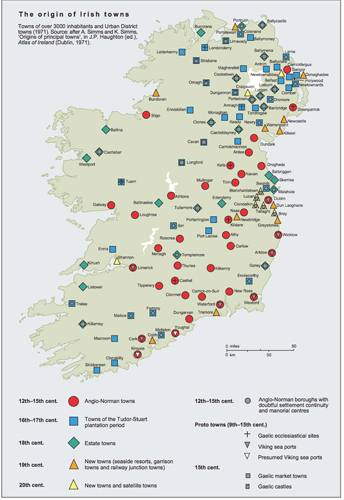
Click image for the full version Origins of towns map.
A simple task for 1st year human geography students is to explore the Origin of Irish Towns map on the IHTA website. Following a series of lectures examining the shaping of the Irish landscape since humans first arrived, we now ask when did people first begin to live in towns? Pairs or small groups confer to examine the map and address a range of questions:
- Where are the earliest towns?
- What are the most common town origins?
- Are there any patterns?
- Are there any problems or issues with the map, how reliable is it?
- What does it tell them about the origin of their home town?
- What surprises them about the map?
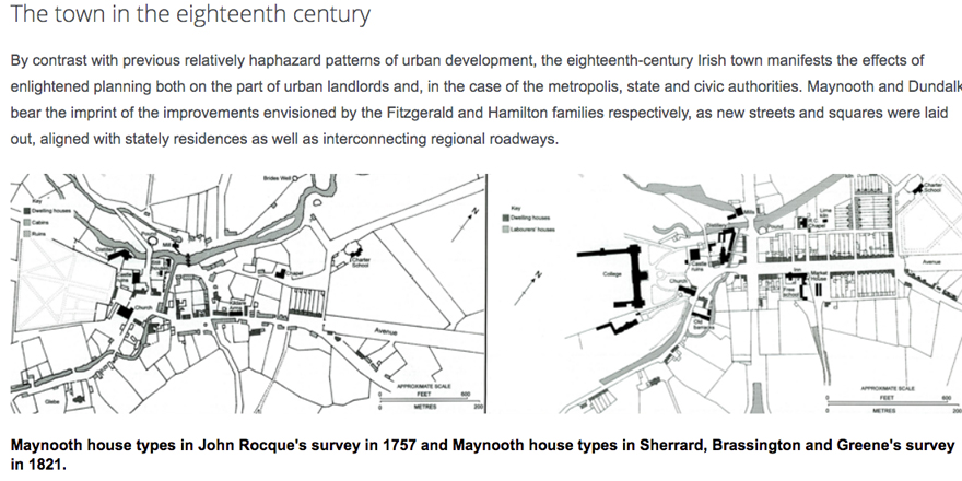
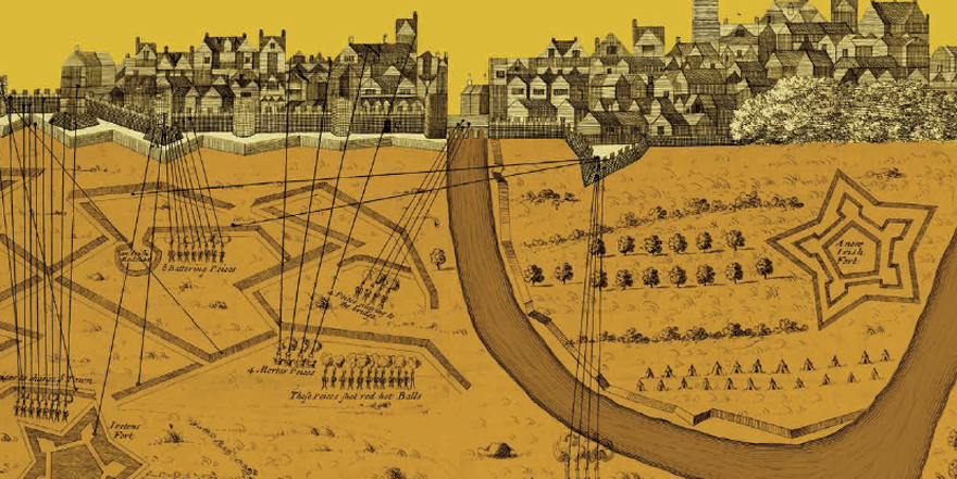
To supplement the map activity, students can then be directed to the relevant chapters of Reading the Maps: a guide to the Irish Historic Towns Atlas by Jacinta Prunty and H.B. Clarke, which can be accessed from the same webpage. This is an invaluable resource which enables the students to delve deeper, includes questions and offers many suggestions for development. For a very quick overview, however, the brief essays on each town type are an ideal starting point. In each case, experts provide their ‘take’, complete with illustrations from the atlas series: e.g. sample above on The town in the eighteenth century by Colm Lennon or see 'Monastic Town' by Anngret Simms here.
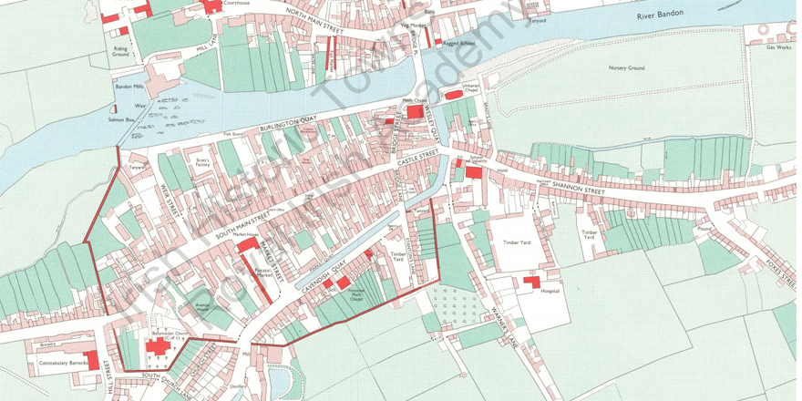
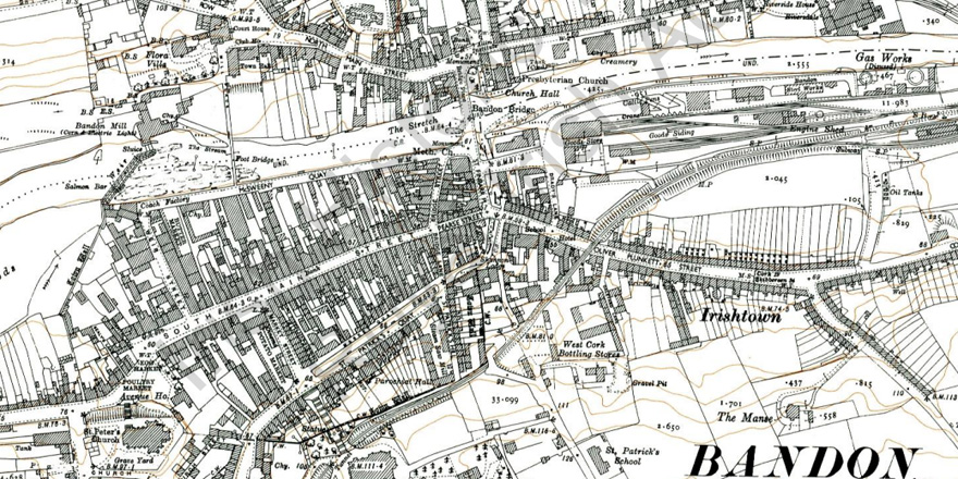
The core maps provided in the online (or hardcopy) version of the atlas, are an ideal tool for building map-reading skills while also examining change through time. This exercise can be undertaken with any town (or even with each team member looking at a different town and comparing their findings), but in this case I have used No. 3 Bandon to explore continuity and change in the landscape, asking what does this tell us about changing society? Students are asked to compare Map 2 (1841) (above) and Map 3 (1938) (below) to identify as many changes over that time period as possible, including infrastructure, industrial activity, housing, evidence of leisure etc. A supplementary activity asks them to identify key features shown on Map 3 (1938) in the present day landscape, using Google StreetView. Where the printed atlas is available, this activity can also draw on the other illustrations which include (depending on the atlas) beautifully reproduced paintings and aerial photographs, all of which provide different insights into the evolving landscape and streetscape.
Final year students tracing the evolution of a Dublin street through time draw on the IHTA in combination with a range of other sources. To begin, they consult Map 25 (No. 26, Dublin Part III, 1756 to 1847) which shows the different growth phases of the city.
Thereafter, the Topographical Information comes into its own – holding clues as to the earliest mentions of the street, which maps to interrogate further, any name changes to be aware of, and other relevant information about land-use etc. The Atlas is a vital first step on their journey of discovery.
To access IHTA Online, (first 27 IHTAs in pdf format) click here.
To access the Digital Atlases, (Derry~Londonderry, Galway, Dungarvan) click here.
*For more on the scholarship set, please contact s.gearty@ria.ie
Ruth McManus, School of History and Geography, Dublin City University is author of IHTA Dublin suburbs, Drumcondra (forthcoming).
You might also like...

Raymond Gillespie MRIA
09 February 2024
We are deeply saddened by the death of our editor and colleague, Raymond Gillespie MRIA, on 8 February 2024.

New online Digital Atlas of Cork/Corcaigh launches today
05 December 2023Today marks the launch of the Digital Atlas of Cork/Corcaigh, a free online interactive map that invites you to discover the built heritage of Cork City in a new way where 6,245 features of the city's history from AD...
Town & Country launch and 'Mapping places, mapping people' lecture
23 November 2023Town & Country: perspectives from the Irish Historic Towns Atlas was launched by Vanessa Harding, chair, Historic Towns Trust last night following a lecture by Howard Clarke 'Mapping places, mapping people: Dublin...