Man, maps and map history: John Andrews, 1927–2019
When
Tuesday, November 17, 2020, 19:30Where
Tickets
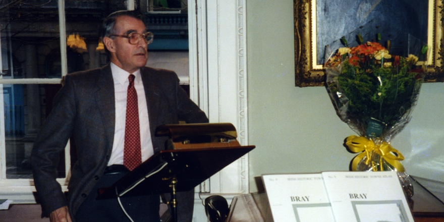
A lecture by Arnold Horner in honour of the life and work of John Andrews, cartographic historian and geographer.
A lecture by Arnold Horner in honour of the life and work of John Andrews, cartographic historian and geographer, who died on 15 November 2019. With a short response by Keith Lilley.
This lecture will be presented live on YouTube and can be viewed here. Register to attend and you will receive a link in advance. There will not be the option to comment or ask questions during the event. The link will be made available after the event.
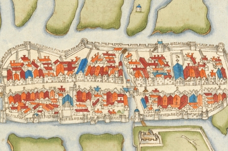
John Andrews was a pioneer and leading expert in studies of the history of cartography (map-making) in Ireland. He taught geography at Trinity College Dublin between 1954 and 1990, becoming Associate Professor in 1977 and a Member of the Royal Irish Academy in 1978. He is particularly associated with two major Academy projects, the Atlas of Ireland (published 1979) and the Irish Historic Towns Atlas (established 1981 and ongoing). His books include A paper landscape (1975), Plantation acres (1985), Shapes of Ireland (1997) and Maps in those days (2009).
Arnold Horner formerly taught geography at University College Dublin. He has written widely on the geography of Ireland, some of his work being on topics related to the academic interests of John Andrews. Recent writings by Arnold Horner include Mapping Laois (2018) and an edited volume for the Irish Manuscripts Commission, Documents relating to the Bogs Commissioners (2019).
Keith Lilley is Professor of Historical Geography at Queen’s University Belfast. His research focuses on maps and landscapes, and the connections between them. His books include Mapping Medieval Geographies (2014) and City and Cosmos (2009), and he is chair of the British Historic Towns Atlas. In 2018, the Royal Geographical Society (with IBG) conferred on him the Cuthbert Peek Award, 'For advancing geographical knowledge through the application of contemporary methods, including GIS and mapping.'
Register for the lecture here.
The Irish Historic Towns Atlas is a research project of the Royal Irish Academy. Series editors: Raymond Gillespie, Howard Clarke, Michael Potterton; consultant editor: Anngret Simms; managing and cartographic editor: Sarah Gearty; editorial assistants: Jennifer Moore, Frank Cullen.
You might also like...
Discourse Series | The future of the EU: Bigger and Better?
When: Thursday, 23 May 2024Join us for a conversation between Mairead McGuinness (EU Commissioner, 2020-24) and broadcaster Olivia O’Leary MRIA.
Reading and collecting books in early modern Ireland and Europe
When: Wednesday, 15 May 2024Dr Elizabethanne Boran and Professor Brendan Dooley describe the landscape of reading and book collecting in early modern Ireland and Europe
Irish Historic Towns Atlas Seminar 2024: 'Marshland to Metropolitan City'
When: Wednesday, 15 May 2024This event is fully booked, but a waiting list is in place. The annual IHTA Seminar, 'Marshland to Metropolitan City: exploring Cork through the Irish Historic Towns Atlas' will take place in Cork on 15 May 2024.