IHTA Youghal now available online
02 April 2020Irish Historic Towns Atlas no. 27 Youghal by David Kelly and Tadhg O'Keeffe, published by the Royal Irish Academy in 2015, is now available to browse for free as part of IHTA Online.
Youghal joins twenty-six other Irish Historic Towns Atlas fascicles available online for download. The atlas has histories of over 1,500 urban sites with Ordnance Survey maps, thematic text maps and historic images in the text section.
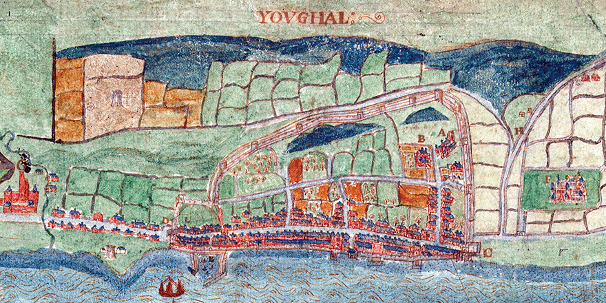
William Jones, 'Youghal', c. 1602 (Hardiman Collection, Trinity College, Dublin).
Youghal is grouped under 'Towns of Anglo-Norman' on IHTA Online and it may be compared with the other Anglo-Norman towns from the IHTA series of no. 2 Carrickfergus by Philip Robinson (1986), no. 5 Mullingar by J.H. Andrews with K.M. Davies (1992), no. 6 Athlone by Harman Murtagh (1994), no. 10 Kilkenny by John Bradley (2000), no. 13 Fethard by Tadhg O'Keeffe (2003), no. 14 Trim by Mark Hennessy, no. 23 Carlingford by Harold O'Sullivan and Raymond Gillespie (2011) and no. 24 Sligo by Fióna Gallagher and Marie-Louise Legg. There are thousands of histories of significant topographical sites and maps of the development of each Anglo-Norman town from mills, castles, churches, streets and town walls to water fountains, markets, theatres and schools.
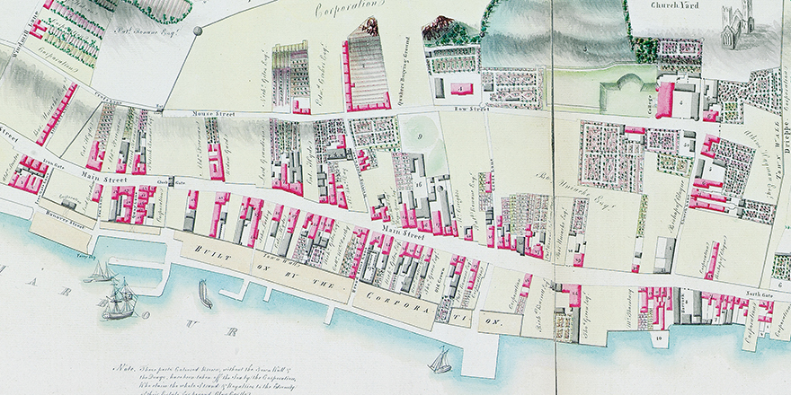
Bernard Scalé, 'The town and gardens of Youghal', 1776 (Devonshire Collection, Chatsworth Estate).
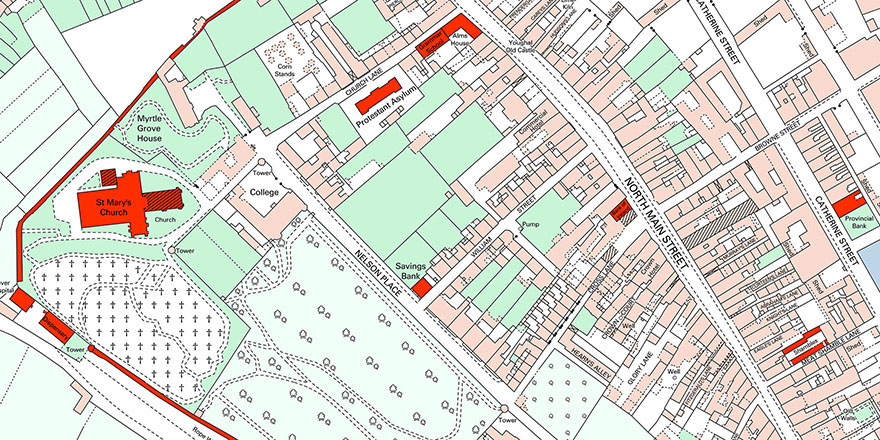
Extract from reconstructed Ordnace Survey manuscript town plan, 1841.
Additional material
Michael Potterton, editor and lecturer in Maynooth University, offers his take on the Anglo-Norman town here with an analysis across a number of IHTA towns here.
Available also, is the chapter on the Anglo-Norman town from Reading the maps: a guide to the Irish Historic Towns Atlas (Dublin, 2011) where the town type is contextualised and case studies given.
Included with each atlas is:
-
The cover, general abbreviations, introduction and select bibliography
-
Word searchable essay, text maps and topographical gazetteer
-
Map 1 (mid-19th cent., 1:50,000), Map 2 (mid-19th cent., 1:2500), Map 3 (modern 20th cent., 1:5000), growth maps, historical compilation maps and legend sheet.
For a full list, or to purchase any of the IHTA publications, click here.
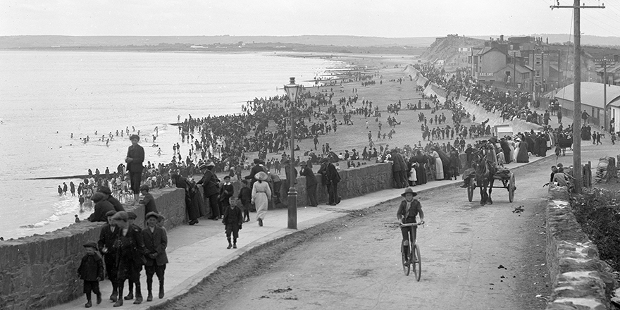
Cover image, Youghal Strand, c. 1900 (Lawrence Collection, National Library of Ireland).
You might also like...

Raymond Gillespie MRIA
09 February 2024
We are deeply saddened by the death of our editor and colleague, Raymond Gillespie MRIA, on 8 February 2024.

New online Digital Atlas of Cork/Corcaigh launches today
05 December 2023Today marks the launch of the Digital Atlas of Cork/Corcaigh, a free online interactive map that invites you to discover the built heritage of Cork City in a new way where 6,245 features of the city's history from AD...
Town & Country launch and 'Mapping places, mapping people' lecture
23 November 2023Town & Country: perspectives from the Irish Historic Towns Atlas was launched by Vanessa Harding, chair, Historic Towns Trust last night following a lecture by Howard Clarke 'Mapping places, mapping people: Dublin...