New publication: More Maps and Texts edited by Clarke and Gearty
09 May 2018More Maps and Texts: sources and the Irish Historic Towns Atlas edited by H.B. Clarke and Sarah Gearty is available to buy online now.
More maps and texts: sources and the Irish Historic Towns Atlas is based on a series of annual seminars run by the Irish Historic Towns Atlas (IHTA) project from 2012 to 2014. Its predecessor Maps and texts: exploring the Irish Historic Towns Atlas was published by the Royal Irish Academy in 2013.
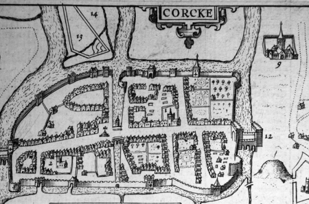
Nineteen essays are presented in the volume, which is structured into three chronological parts: monastic proto-towns and Viking towns; Anglo-Norman, gaelicised and plantation towns; and Georgian and Victorian towns. An introductory essay deals with a selection of standard sources that have been used by the IHTA. Subjects range from the meaning of placenames, to the art historical perspective, to the impact of canals and railways on towns. The twenty-eight published IHTA fascicles provide the basis for the research and the emphasis is on the cartographical and historical sources — their nature and utility — that are available for the study of Irish towns.
Most of the contributors to this volume are not authors of IHTA fascicles, thus enabling them to cast a fresh and, on occasion, a more critical eye over what heretofore has been achieved.
‘Like the earlier volume, not only is More maps and texts an indispensable resource for Irish researchers but it offers considerable intellectual stimulation for urban historians everywhere’. Professor Tadhg O’Keeffe, University College Dublin.
More Maps and Texts can be bought online here.
Contents and contributors
1.Sources for town atlases (H.B. Clarke and Sarah Gearty) 2.Environment (H.B. Clarke) 3.Placenames (Nollaig Ó Muraíle) 4.Religion (Catherine Swift) 5. Derry~Londonderry (Brian Lacey) 6.Limerick (Brian Hodkinson) 7.From Gaelic church settlements to Anglo-Norman towns: problems and possibilities (Cóilín Ó Drisceoil) 8.Anglo-Norman towns based on castles (Margaret Murphy) 9.Anglo-Norman towns based on coastal and riverine trading activity (Andy Halpin)10.Gaelic towns? Tuam, Longford, Sligo and Ennis (Sarah Gearty) 11.Colonial towns, 1500–1700: Carrickfergus, Downpatrick and Belfast (Raymond Gillespie) 12.Plantation towns: Bandon, Derry~Londonderry and Armagh (Annaleigh Margey) 13.An art-historical perspective on the Irish Historic Towns Atlas (Rachel Moss) 14.The Big House and town improvement (Toby Barnard) 15.Exploring the impact of the canals: Limerick, Maynooth, Mullingar and Longford (Arnold Horner) 16.Military barracks in an age of revolt and war (David A. Fleming) 17.Valuation maps (Hélène Bradley-Davies and Marie Taylor) 18.The railway and the urban landscape: assessing the impact in Dublin, Belfast, Dundalk and Bray (Frank Cullen) 19.From Georgian to Victorian: Dublin 1756 to 1847 (Rob Goodbody)


