
IHTA Towns in the Nineteenth Century now available online
16 June 2017Irish Historic Towns Atlases of Bray and Belfast, part II, 1840 to 1900 are now freely available to search and download.
Launch
Jacinta Prunty, Maynooth University, board member of the Irish Historic Towns Atlas and co-author of Galway, recently launched the latest in the IHTA Online series: Towns in the nineteenth century. It joins twenty-three other atlases under the themes of:
- Towns of Monastic Origin
- Towns of Viking Origin
- Towns of Anglo-Norman Origin
- Early modern, Gaelic and Plantation towns
- Towns in the Eighteenth-Century
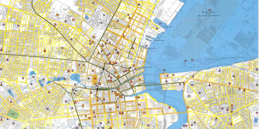
Extract from historical map of Belfast c. 1600 to c. 1900
Towns in the nineteenth century
The IHTA towns in the nineteenth century of no. 9 Bray by K.M. Davies (1998) and no. 17 Belfast, part II, 1840 to 1900 by Stephen A. Royle (2007) are available to browse, download and compare with each other as well as with the other twenty-three towns already available online. Bray developed as a seaside resort with the expansion of the rail network and Belfast became the industrial capital of Ireland, primarily of the textile and shipping industries, with its population surpassing that of Dublin in the latter nineteenth-century. These changes are recorded in the atlases with maps and historical documentary evidence of thousands of sites.
To accompany this launch, the chapter on from Reading the maps: a guide to the Irish Historic Towns Atlas (Dublin, 2011) is included so the reader can contextualise the town type and see different samples from different towns and case studies.
Included with each atlas is:
- The cover, general abbreviations, introduction and select bibliography
- Word searchable essay, text maps and topographical gazetteer
- Map 1 (mid-19th cent., 1:50,000)*, Map 2 (mid-19th cent., 1:2500), Map 3 (modern 20th/21st cent., 1:5000)*, growth maps, historical compilation maps (where available) and legend sheet.
*Due to copyright reasons, not all historical maps and views can be reproduced online, but are available in the print editions.
You might also like...

Raymond Gillespie MRIA
09 February 2024
We are deeply saddened by the death of our editor and colleague, Raymond Gillespie MRIA, on 8 February 2024.

New online Digital Atlas of Cork/Corcaigh launches today
05 December 2023Today marks the launch of the Digital Atlas of Cork/Corcaigh, a free online interactive map that invites you to discover the built heritage of Cork City in a new way where 6,245 features of the city's history from AD...
Town & Country launch and 'Mapping places, mapping people' lecture
23 November 2023Town & Country: perspectives from the Irish Historic Towns Atlas was launched by Vanessa Harding, chair, Historic Towns Trust last night following a lecture by Howard Clarke 'Mapping places, mapping people: Dublin...