The maps that keep on giving …
26 August 2016Ordnance Survey 6-inch maps (1833-46): Dr Patrick Duffy’s Heritage Week lecture at the RIA Library and more.
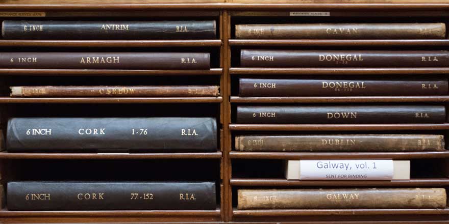
Between 1833 and 1846 the Ordnance Survey produced maps for every Irish county on a scale of 6- inches to the mile. This was not the first survey of Ireland, nor would it be the last, but the ambition to capture ‘everything that didn’t move’[1] ─ the sheer scale and scope of the undertaking ─ ensured that the 6” mapping of Ireland was a groundbreaker.
Dr Patrick Duffy, emeritus professor of geography, Maynooth University, delivered a riveting lecture to a capacity attendance on 22 August 2016 as part of the Academy Library’s Heritage Week events. Dr Duffy outlined the context for the Survey which was carried out by Ordnance engineers and officers, trained at the Royal Military College, Woolwich, and assisted by a huge team of sappers. One of the project’s drivers was the general urge to measure and map the world using scientific principles, influenced by the Enlightenment emphasis on scientific reasoning. Another impetus was the then British Empire’s global reach and the need for intimate knowledge of all aspects of the diverse lands under its control. The administration of Ireland would be better served by a map of the landscape which would show not only the physical features but also the political, economic and historic elements ─ towns, villages, estates, military installations, bleach greens, mills, antiquities, etc. A key motivation for mapping on this unprecedented scale was the need for a means to strike a proportionate rateable valuation.
The maps of Ireland, and later of India[2] and elsewhere, were also a way of displaying ‘selected aspects of the colonies’.[3] The Survey produced not only the wonderful 6”-maps but also a series of Memoirs, records containing statistical information about the localities mapped ─ this could include the type of economic activity in each area, the crops sown, or the presence of fisheries, or flour, linen or paper mills. The Memoirs also indicate the type and number of churches, meeting houses and schools in each townland or parish. Funding constraints led to the cessation of the Memoir-gathering exercise, leaving records of this kind for Ulster only.[4]
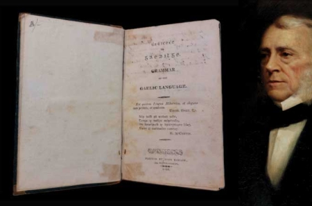
Of course, one of the sticking points in the compilation of the maps was the challenge of recording Irish placenames. The great Irish scholar, John O’Donovan, was employed to work in the field with the surveyors, researching and verifying the names. O’Donovan’s Name Books are held at the National Archives. Simultaneously, O’Donovan, with his encyclopaedic knowledge of the history, lore, language and antiquities of the country, conducted an almost daily correspondence[5] with Thomas Larcom, 1801–79. Larcom, assistant director to Thomas Colby, director of the Survey, was a hugely energetic and able administrator: he oversaw the day-to-day running of the Survey and the antiquarians appointed to support the surveyors reported to him.
The core resource ─ 26 volumes of county maps ─ formed the basis for Richard Griffith’s Valuation and his valuation maps, and also for the Geological Survey of Ireland, for the 1841 census of Ireland and for the establishment of Poor Law Unions (1842–9); the latter resulted in the extension of the franchise to the tenants of electoral divisions who elected members to the Poor Law boards. In short, the maps provided a basis, in a sense like a modern GIS, for the layering of further surveys and research, resulting in information of all kinds which can be still be mined by us today ─ the maps that keep on giving.
The Academy Library’s set of signed 1st-edition maps is a much-used, open-access resource, not only beloved by historians and genealogists but also by many members of the public who use them to research their local and family history. Some volumes are now in need of repair and conservation. We are grateful for a Heritage Council grant in 2016 towards the work but we need to raise supplementary funding to complete it. We have launched an OS map funding appeal and are delighted to announce that already over €1,000 has been raised thanks to the generosity of friends and supporters of our heritage.
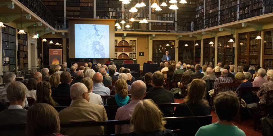
We should like to acknowledge the Heritage Council for their grant of €4,000 towards our OS map conservation project and Dr Patrick Duffy for his splendid Heritage Week lecture on the Ordnance Survey’s achievement*. We also acknowledge with gratitude the donations to our appeal; all donors will be acknowledged individually.
Siobhán Fitzpatrick
Librarian
For further details on the OS archives please check here.
Listen here to an earlier series of lectures on the OS.
*We regret that Professor Patrick J. Duffy's lecture which took place during Heritage Week 2016 is unavailable due to poor recording quality.
[1]Patrick Duffy, ‘Colonial experiments in geographical information systems: the Ordnance Survey and other archival databases in nineteenth-century Ireland’, lecture delivered at the Royal Irish Academy Library, 22 Aug., 2016 (available shortly as a podcast).
[2] George Everest, 1790–1866, superintendent of the Trigonometrical Survey of India (1823–43) visited the OS in Ireland in 1829 and was the first to describe the compensation bars designed to measure the baseline at Magilligan on Lough Foyle.
[3] Duffy, ‘Colonial experiments’.
[4] The originals are held by the Academy Library and have been published by Queen’s University Belfast, Inst. of Irish Studies: Angélique Day & Patrick McWilliams (eds), Ordnance Survey Memoirs of Ireland (40 vols, Belfast, 1990–98).
[5] The O’Donovan OS Letters are also held by the Academy; most of these have been edited and published in 17 volumes by the late Dr Michael Herity, MRIA, 1929–2016: Michael Herity (ed.), Ordnance Survey Letters … (17 vols, Dublin, 2000–14).
You might also like...
Library blog: Cynthia Longfield and the St George expedition
19 April 2024This blog marks the centenary of Cynthia Longfield's adventure on the 1924 St George scientific expedition.
Bailiúchán Thionscadal Gréasáin Cheirníní Doegen – Guthanna an Ama atá thart á gCaomhnú
05 March 2024In celebration of Seachtain na Gaeilge we are pleased to highlight an important Irish language collection of audio recordings - the Doegen Records.
Book sales, brothers, and Bonaparte!
06 February 2024In our latest library blog, a recent donation with an intriguing inscription offers a window into the life of the Haliday family and their fascinating circle of friends.