Irish Historic Towns Atlas Seminar
Marshland to metropolitan city: exploring Cork through the Irish Historic Towns Atlas
To celebrate the launch of Irish Historic Towns Atlas no. 31 Cork/Corcaigh by H.B. Clarke and Máire Ní Laoi, the 2024 IHTA Seminar will be dedicated to the city of Cork and will take place on 15 May 2024 in the former Cork Savings Bank, now UCC Centre for Executive Education. It is fully booked out, but a waiting list is in place here.
Speakers include: Brian Magee, Ciara Brett, Colin Rynne, Crónán Ó Doibhlin, Danielle O'Donovan and Gillian O'Brien, Finola O'Kane, Frank Keohane, Howard Clarke, John Hegarty, Maura Cronin, Maurice Hurley, Michael Lenihan, Michael Waldron and Tom Spalding the full programme is available here.
Using the Atlas: IHTA Workshops 2022
The series of workshops that took place on 19 May 2022 was an interdisciplinary approach of how the IHTA has been and could be used – in education by researchers, teachers and students; and in practice by heritage professionals, archaeologists, architects and planners, archivists and librarians. Convened in association with the Historic Towns Trust/British Historic Towns Atlas, the day culminated with a plenary lecture by Professor David Dickson (Trinity College Dublin). For the full programme, click here.
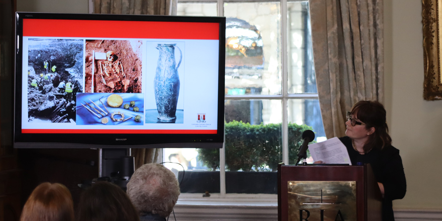
The series commenced with a short introduction by Sarah Gearty (Cartographic and Managing Editor of the IHTA). Michael Potterton (Maynooth University and chair of the IHTA Editorial Board) chaired the first session on Archaeology. Ciara Brett (City Archaeologist, Cork City Council) spoke about how the local authorities can make use of atlas material by using examples in Kildare and while the Cork atlas is not yet published, she has been able to use some of the draft topographical information in uncovering street names for example. A comment from online by Sarah McCutcheon (Executive Archaeologist, Limerick City and County Council) added that IHTA Limerick has assisted around flood planning in the city.
Daniel Tietzsch-Tyler (independent scholar) demonstrated how the IHTA has assisted in his reconstruction drawings, focusing on Fethard, and how the atlas can assist in creating a contemporary topographic environment. He demonstrated how he thoroughly investigates the maps, documentary evidence and IHTA analysis in how buildings and plots have morphed over the centuries.
Watch back Introduction and Archaeology Workshop here.

Keith Lilley (Queen's University Belfast and chair Historic Towns Trust) both chaired and spoke during the workshop based on Third-Level Teaching. His paper highlighted importance of the IHTA in the geography classroom and stressed the importance of maps and fieldwork and that the IHTA can be used across different levels of complexity and explained how the urban landscape is a record of its own evolution.
Annaleigh Margey (Dundalk Institute of Technology) looked at how the teaching of history has changed from a traditional lecture format, to a more interactive approach making use of the digital sources available, particularly that of IHTA Online. A useful project followed the methodology of the Digital Atlas of Derry~Londonderry and produced a version for Dundalk using material from the IHTA and other archival sources.
Ciaran McCabe (Dublin City University) focused on how he teaches the development of urban centres in Ireland in the early-modern period. Case studies of published IHTA towns are used to assist students in creating more critical thinking around the evolution of urban form in the plantation period.
Watch back Third-Level Teaching Workshop here.
Brendan Teeling (Dublin City Deputy Librarian) chaired the second workshop – Libraries and Archives. Bernadette Cunningham (former Deputy Librarian, Royal Irish Academy) discussed how she directed researchers of urban history to the IHTA in the RIA Library and as a case study, how she delved deep into the Dublin IHTA to discover if the original St James's Gate had a connection with the pilgrim route to Santigo de Compostella. She found that the bibliographical information supplied her with the sources she needed to uncover the date of the gate.
Bláithín Hurley (Local Studies Department, Waterford Libraries) spoke on how the IHTA has not been used in the Waterford Libraries yet and how perceived boundaries to use the atlas can be broken, not only for the public researchers, but also for librarians who can learn more about the IHTA and how it can be applied to local history researchers.
Watch back Libraries and Archives Workshop here.
Miriam Fitzpatrick (University College Dublin) chaired the first afternoon workshop on Architecture and Planning where Derry O'Connell (University College Dublin) detailed the use of the atlas in urban design. He spoke about life before and life after the atlas in design projects using IHTAs Sligo and Mullingar as an examples in understanding complex urban plots. He also compared urban morphology across Europe.
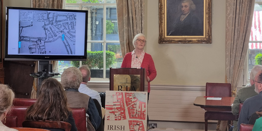
Nicola Matthews (Senior Architect, Department of Housing, Local Government and Housing) detailed the Aungier Street Study, the first planned suburb in Dublin, laid out in 1661 by the Earl of Longford, Francis Aungier. The cross-departmental project comprising of Dublin City Architects Conservation Team with research carried out by Dublin Civic Trust and funding from Dublin City Council and the Heritage Council used the IHTA for Dublin that allowed the project to immerse themselves in late seventeenth-century Dublin to understand the concept behind the development of the suburb.
Watch back Architecture and Planning workshop here.
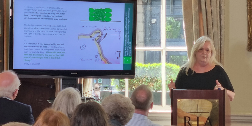
For the Local History and Research workshop, Raymond Gillespie (Maynooth University and IHTA Editorial Board member) introduced Brendan O'Malley (independent scholar) and Elizabeth Shotton (University College Dublin). Brendan's paper focused on one building in Limerick, the Round House, and how he used the maps of IHTA Limerick to decipher when it was built. Elizabeth Shotton spoke on her harbour research and the discovery of the harbour at Newhaven. She used the Carrickfergus atlas to assist in dating the style of harbour at New Haven, which, in turn, opened up comparisons with Dover.
Watch back Local History and Research Workshop here.

The final workshop of the day was on Digital Mapping and chaired by Rachel Murphy (University of Limerick and Chair of the IHTA Digital Working Group). Brian Lambkin (Mellon Centre for Migration Studies) discussed the Citizens Atlas of Local Migration (CALM) project, which used the IHTA Digital Atlas of Derry~Londonderry that was initially produced in 2013. Good examples of field work and mixing of traditional and digital sources were used in creating the CALM project.
John Elliott (independent scholar) spoke on his interest in the development of medieval and early modern Limerick. He has been involved in creating the Digital Atlas of Limerick with Limerick Museum for several years. He used IHTA Limerick as a foundation for further research into various sources, including the Registry of Deeds. His paper focused on the main street, Nicholas Street and Mary Street, to trace the changes to the buildings over time in the early modern and modern periods.
Watch back Digital Mapping Workshop here.
David Dickson (Trinity College Dublin) delivered the plenary lecture – 'Writing Irish Urban History: the sunny uplands and shadows below', which was chaired by Jonathan Wright (Maynooth University and IHTA Editorial Board member). Dickson acknowledged the importance of John Rocque to Ireland's cartographic history from the mid-eighteenth century and that the work of the Ordnance Survey, under Thomas Colby, in this current digital age, probably has bigger impact than ever before.
Watch back the Plenary Lecture here.
| Workshop | Speakers | Links |
| 1 Archaeology (& introduction) | Ciara Brett and Daniel Tietzsch | Watch here |
| 2 Third-Level Teaching | Keith Lilley, Annaleigh Margey and Ciaran McCabe | Watch here |
| 3 Libraries and Archives | Bernadette Cunningham and Bláithín Hurley | Watch here |
| 4 Architecture and Planning | Derry O'Connell and Nicola Matthews | Watch here |
| 5 Local History and Research | Brendan O'Malley and Elizabeth Shotton | Watch here |
| 6 Digital Mapping | Brian Lambkin and John Elliott | Watch here |
| 7 Plenary Lecture | David Dickson | Watch here |
IHTA Seminar 2021
'Town and Country: perspectives from the Irish Historic Towns Atlas' took place online over four Thursdays in May.
With some notable exceptions, the historic relationships between urban centres in Ireland and their rural hinterlands have received surprisingly little attention. Towns and the countryside have long been viewed as entirely separate entities having little in common with one another. As centres of administration, education, entertainment, finance, healthcare, industry, justice, religion and trade, towns had to be supplied and sustained by a variety of hinterlands providing food, fuel, labour, raw materials and customers for craft goods and imported wares. The 2021 IHTA seminar will explore the nature and evolution of town–country relationships in Ireland through the ages, a field just now beginning to receive the attention it deserves. Convened by the Irish Historic Towns Atlas in collaboration with the British Historic Towns Atlas/Historic Towns Trust and Dublin City Council. Royal Irish Academy #IHTA2021 #TownandCountry
Click here for full programme.
| Date | Session | Speakers | Link |
| 6.5.2021 | 'Monastic tenants, Viking raiders and Hiberno-Norse townspeople' | Howard Clarke and Ruth Johnson | watch here |
| 13.5.2021 | 'Town and country in later medieval Ireland' | Michael Potterton, Jim Galloway and Margaret Murphy | watch here |
| 20.5.2021 | 'Lawyers, merchants and peasants: town and country interaction in early modern Ireland' | Raymond Gillespie and Brendan Scott | watch here |
| 27.5.2021 | 'From outlying villages to townships: Dublin suburbs in the nineteenth century' | Ruth McManus, Séamas Ó Maitiú, Frank Cullen, introduced by Colm Lennon | watch here |
| 27.5.2021 | ‘Medieval towns: Why we need to take account of the country’ | Chris Dyer, chaired by Keith Lilley | watch here |
IHTA Seminar 2019: Seascapes and Townscapes — Ports and the Nineteenth-Century City
The 2019 IHTA Seminar took place in Dublin Port Company HQ and the Royal Irish Academy on 16 and 17 May 2019 and was convened by the Irish Historic Towns Atlas (IHTA) in collaboration with the British Historic Towns Atlas/Historic Towns Trust (HTT) and the Royal Irish Academy and in association with Dublin Port Company.
'Where townscapes meet seascapes, ports are a significant feature of our nineteenth-century urban inheritance. The topographic, environmental and cartographic impacts of ‘the port’ on urban landscapes is well represented in the Irish Historic Towns Atlas series, as exemplified by the IHTA published fascicles and volumes, for Dublin, Belfast, Derry~Londonderry, Drogheda, Dundalk, Galway, Limerick, Sligo and Youghal, as well as in preparation, as in the case of Cork, Dungarvan and New Ross.
The 2019 annual seminar of the Irish Historic Towns Atlas explored the evolution of port functions, infrastructures and topography on the island of Ireland, as well as its associations with the broader nineteenth-century urban experience, in Britain and in Europe, since ports function as the gateways connecting Irish towns and cities with wider urban worlds.
#IHTA2019
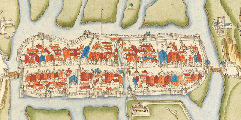
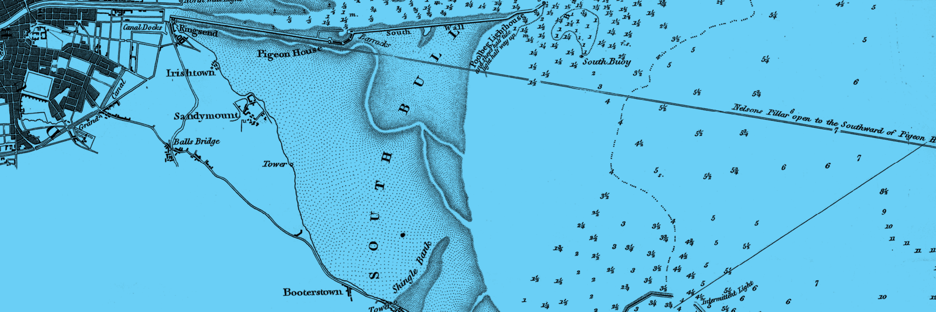
Image details: ‘Survey of Dublin Bay and the adjacent banks’ by William Mudge and G.A. Frazer, 1828. Admiralty Chart 043 Dublin Bay, courtesy the Map Library, Trinity College Library Dublin.
IHTA Seminar 2018 report
'Modernising townscapes: urban evolution in Ireland and Great Britain from the Reformation to industrialisation, 1540–1840'
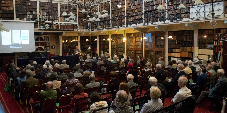
Last year's IHTA Seminar took place on Friday 18 May 2018. There was also be a public lecture to open the seminar on Thursday 17 May 2018 by Professor Roey Sweet (University of Leicester), both in Academy House.
The 2018 annual seminar of the Irish Historic Towns Atlas (IHTA) was being convened in collaboration with the British Historic Towns Atlas/Historic Towns Trust (HTT) and explored the similarities and differences to be found in the urban landscapes of our two neighbouring islands, reflecting on their shared and connected histories, as well as on the common purposes of the two atlas projects. Focusing on 'Modernising Townscapes', the seminar compared towns and cities of both Ireland and Britain through time. The aim was to explore urban evolution in Ireland and Britain from the Reformation to Industrialisation (1540–1840) and examined how, despite close geographical proximity, local factors and influences were important in shaping urban landscapes across the two islands as much as wider common structures and proceses, such as religion, warfare, defence, lordship and commerce.
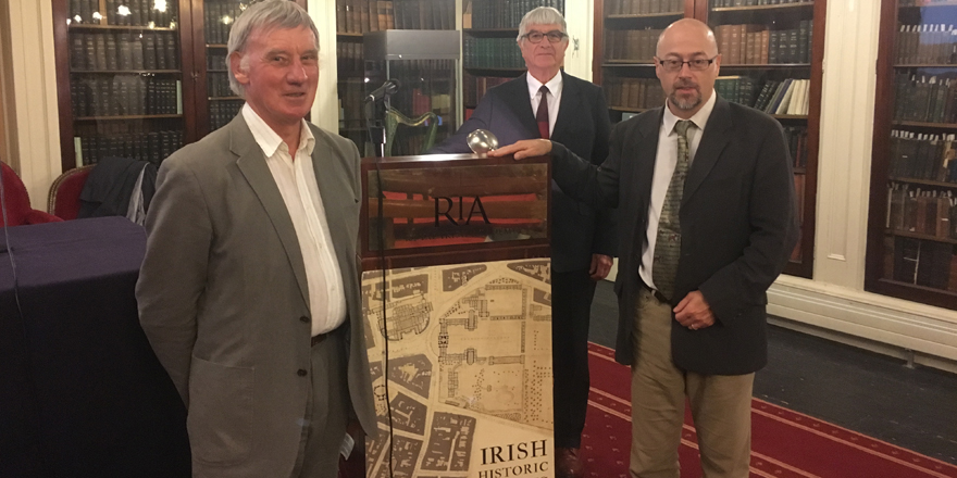
Contributors to More maps and texts: sources and the Irish Historic Towns Atlas edited by H.B. Clarke and Sarah Gearty, launched by Keith Lilley at the end of the IHTA seminar 2018.
IHTA Seminar 2017 Report
Last year's IHTA Seminar took place on 19 May 2017. There was also a public lecture to open the seminar on Thursday 18 May, both in Academy House.
Public Lecture
Howard Clarke, chair, with Roger Kain and Keith Lilley who responded to the lecutre
'Mapping towns through time' was delivered by Professor Roger J.P. Kain, School of Advanced Study, University of London. He is a leading cartographic historian and has published thirteen books on maps including most recently, British town maps: a history.
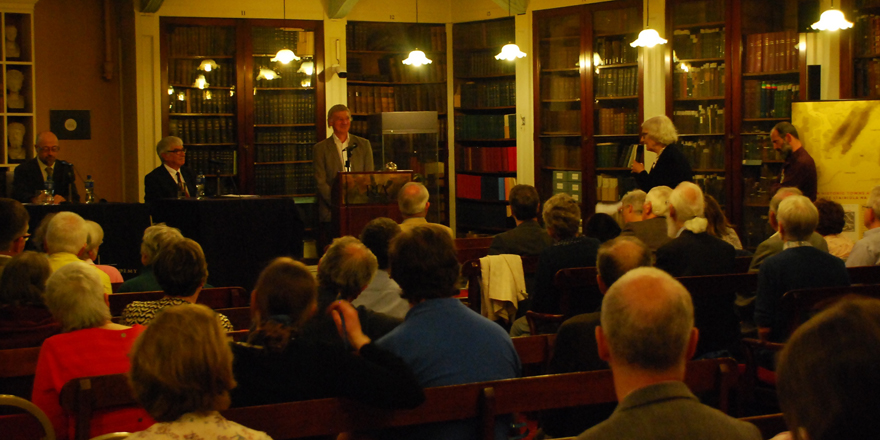
Anngret Simms asks a question to Roger Kain on his lecture
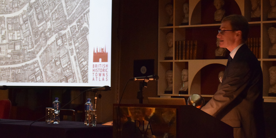
IHTA Seminar 2017
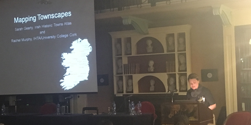
Sarah Gearty delivering her paper in the Cartographic Connections session
This year's theme was 'Mapping townscapes: comparative perspectives through the Irish and British historic towns atlases'. Speakers included Arnold Horner, Jacinta Prunty, Nick Millea, Giles Darkes, Keith Lilley, Sarah Gearty and Rachel Murphy. There was also an international panel discussion with Colin Bray (OSI), Eamonn Doyle (ESRI), Daniel Stracke (Institute for Comparative Urban History, Germany) and Anngret Simms (European Historic Towns Atlas). The seminar was kindly supported by the Irihs Walled Towns Network.
Nick Millea during his paper in the Cartographic Contexts session
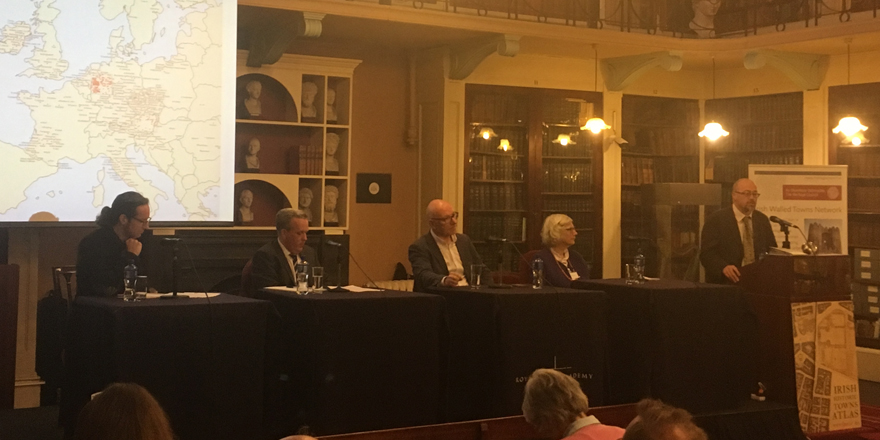
Pleanary session with Daniel Stracke (Institute for Comparative Urban History, Münster), Colin Bray (OSi), Eamonn Doyle (Esri Ireland), Anngret Simms (European Historic Atlas Project) and Keith Lilley (chair, HTT)
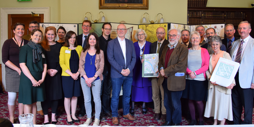
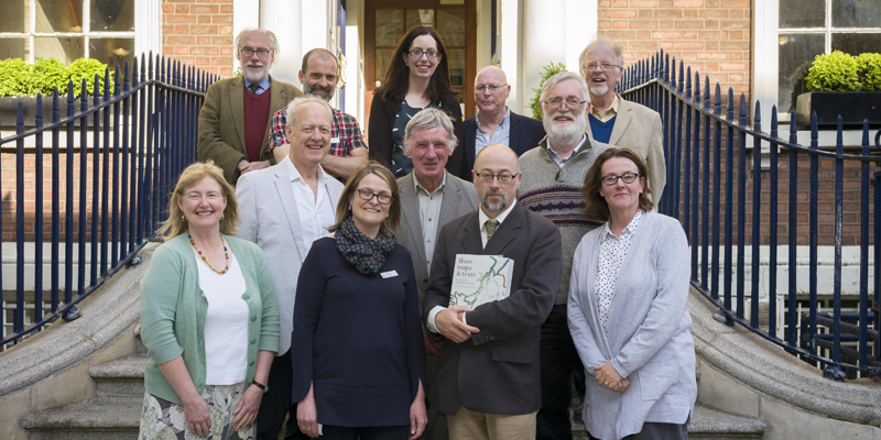
Members of the Irish and British Historic Towns Atlas teams
For the full programme please click here.
IHTA Seminar 2016 Report
The 2016 annual seminar of the Irish Historic Towns Atlas (IHTA) was convened in collaboration with the British Historic Towns Atlas/Historic Towns Trust (HTT) and explored the similarities and differences to be found in the urban landscapes of our two neighbouring islands, reflecting on their shared and connected histories, as well as on the common purposes of the two atlas projects. Focusing on 'medieval townscapes', the 2016 seminar compared towns and cities of both Ireland and Britain using a thematic structure to consider how, despite the close geographical proximity of Ireland and Britain, their urban landscapes in the Middle Ages were shaped as much by local factors and influences as they were by common structures and concerns, such as religion, warfare, defence, lordship and commerce.
The seminar took place in Academy House, 19 Dawson Street, Dublin 2 on Friday, 20 May 2016.
Comparisons were made with Bristol and Galway; Kilkenny and Norwich; Limerick and York; Caernarfon and New Ross; London and Dublin.
The plenary session was delivered by Terry Slater (University of Birmingham): 'Comparing medieval towns in Britain and Ireland: a plan-analytical approach using the historic towns atlases'.
Full programme available here.
Image: Portolan chart extract by Albino de Canepa 1489 (c) James Ford Bell Library, University of Minnesota