Digital Atlas of Cork/Corcaigh
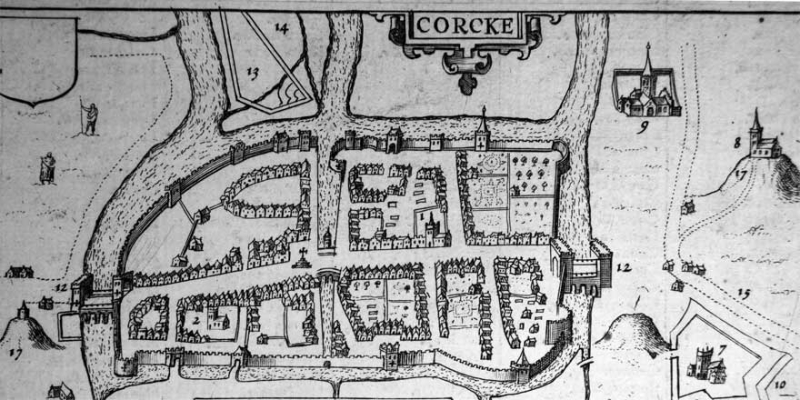
The Digital Atlas of Cork/Corcaigh is an interactive map that invites online visitors to discover the city of Cork in a new way by exploring early maps of different dates and detailed historical information for 6,245 sites.
This Digital Atlas is based on research carried out for Irish Historic Towns Atlas, no. 31, Cork/Corcaigh by H.B. Clarke and Máire Ní Laoi (May 2024).
Explore the Digital Atlas of Cork/Corcaigh
Features of Cork city’s history have been mapped by theme, such as religion, education, defence and manufacturing on to the present-day street plan. The atlas can be searched or browsed. Information on individual sites is available by searching and via pop-up boxes, where critical dates and references are supplied.
Click here to access the Digital Atlas of Cork/Corcaigh
Read more about the Digital Atlas of Cork/Corcaigh.
For sources, click here for a users guide; here for the bibliography; and here for the general abbreviations.
The Digital Atlas of Cork has been funded by the Heritage Council Stewardship Fund 2023. An initiative of the Digital Working Group of the Irish Historic Towns Atlas, Royal Irish Academy it has been supported by partners Cork City Council, the Digital Repository of Ireland, Tailte Éireann/Ordnance Survey Ireland and the National Archives of Ireland. The Atlas was created using ESRI’s ArcGIS Experience Builder.